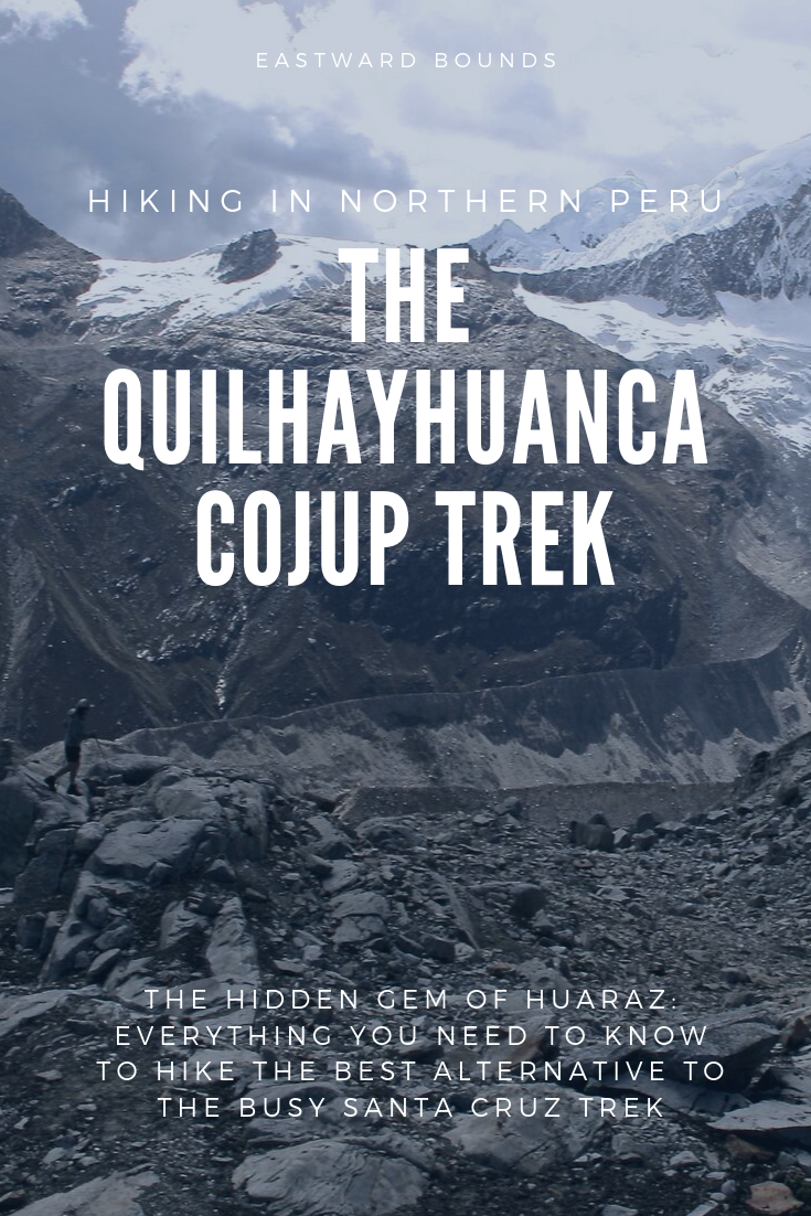
How to Hike the Quilcayhuanca Cojup Trek, the Hidden Gem of Huaraz
Only have a few days in northern Peru, but want to enjoy the spectacular mountain scenery? Tired of seeing another advertisement for a tour group leaving for The Santa Cruz Trek?
Quilcayhuanca Cojup is the answer. No people. No dogs. Nothing but snow-capped scenery, just 30 minutes from Huaraz.
This is the best two to three day hike we’ve ever done. No joke. And here’s everything you need to know hike it yourself (without a guide).
Navigational files included in the maps section, cause we’re nice like that! Scroll to the bottom for our route description.
Trek Overview
We've said it before and we'll say it again: Huaraz, in northern Peru, has some of the best hiking in the world. Thanks to ancient civilizations in the region, trails are well defined for the most part and take you past incredible mountains in very short amounts of time.
The most famous trek in the region is the Santa Cruz, which passes by its namesake mountain. While it is worthwhile, the many people, cows, dogs, and general traffic en route can get tiring. Or maybe you're like us and just can't get enough of hiking in these Cordilleras. In this case, you’ll need to do both.
Either way, the Quilcayhuanca Cojup trek has our pick for best bang for your buck in the region. In just 2-4 days, you can get views that rival the 7-11 day Huayhuash circuit.

Quilcayhuanca and Cojup are two adjacent valleys, separated by the very high but technically easy Huapi Pass. On this trek, you basically walk up one valley and down the other. Very manageable.
And yet, there's little online about this awesome trek. Read our report for everything you know to hike this hidden gem, without a guide.
Getting to and from the Trail
This map should give you a rough - very rough - idea of where you’re going in the region. Huaraz, Llupa, Pitec, and the two valleys in question. Please whatever you do don’t use it for more than prelim planning.
For more precise pins, we have our bookmarks saved from the hike in kmz format here:
We don’t earn any commission on these, we just wanted to provide files cause they’re so helpful for us when we’re hiking.
Open these on your mobile in maps.me and you should be able to follow along pretty well. You’ll see the trails, towns, camp spots, pass… everything you need on the ground. Let us know if you have any trouble with the format.
To/from the huaraz
Huaraz is the biggest city in this region of Peru, easily accessible from Lima and other major cities by bus or plane. Being cheap, we of course chose the bus, which costs between 30 and 80 soles overnight, depending on the level of luxury.
Directional considerations
One of the best things about this trek is how close it is to Huaraz, much easier to access than Santa Cruz from the city.
You can start from either Cojup or Quilcayhuanca valley. The descent is much steeper on the Cojup side, so many people like starting from Quilcayhuanca like we did. It's not a sketchy descent by any means, and going this way definitely saves you some huffing and puffing, so we would recommend it.
To/From Pitec
From Huaraz, you're simply looking for a combi (share van) up the valley in the direction of Pitec. These leave regularly until dusk from Cajamarca relatively near the market.
Now, Pitec is a touristy "town" and the start to the popular Lake Chirrup trek as well as the closest access point to Quebrada Quilcayhuanca. Thus, you will pay for the luxury of getting there: it's 10 soles for 45 minutes.
To/From Llupa
You can also start at Llupa, slightly lower down the valley. This takes about 30 minutes and costs only 1.5 soles. It's a hot, dusty walk up the road/on local footpaths, but it only takes a couple hours and could be worth it.
To/From Cojup
On the Cojup side, you'll have to walk a bit unless you want to take a taxi. You can easily walk down the road to either Llupa or Marian, both of which have regular combis to Huaraz.
Preparations
This is a relatively easy, short three day hike that could be attempted by anyone with some understanding of backpacking, mountain safety, and navigation. It's not as quite as straightforward as Santa Cruz, but it's pretty darn close.
Altitude
The trek goes over Huapi pass, one of the highest in the region at over 5000m. So, you will need to be somewhat acclimitized to do it. Do read up on altitude sickness before you go.
However, you'll sleep relatively low, so won't feel the thin air as much as treks like Huayhuash and Alpamayo Basecamp where you'll be sleeping well over 4000m almost every day.
We took one day in Huaraz, and two days doing day hikes before we set off.
Supplies
There's no accommodation or food along the way, so you'll need to be totally self sufficient.
Gear
We travel with all our backpacking gear, so we only needed to buy gas in town, which is available if expensive (30 soles for a large). We even brought some yummy backpacking food from home.
However, that's not necessary at all, just luxurious. You can buy or rent all you need in Huaraz. There's tons of good food options like pasta, nuts, honey, fruits, peanut butter, candy, etc. in the markets and stores of Huaraz. Nothing fancy though.
Water
There's plenty of water, though you'll need to purify. If you don’t bring your own devices, there are tablets. available at the pharmacies in town.
Below is our favorite water-purification device - well, so far. The Steripen is fast, easy to use, and doesn’t leave a gross after taste. Plus, this model is rechargeable, which avoids expensive batteries.
If you buy through our links, we may earn a small commission (which is dope for us!), but it’ll never charge you, and we’ll only ever recommend products we truly believe in. Promise.

Safety
Help will be a day's walk away at any given time. You probably won't pass many people otherwise. In fact, there are no villages or houses in the valleys themselves, which means you don't have to deal with and pesky dogs or livestock.
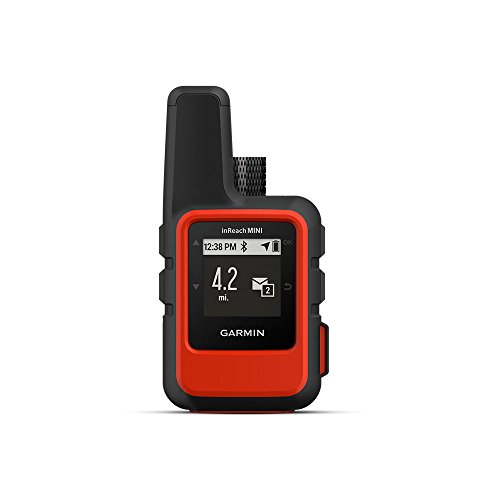
There's no cell service for most of the trip. We carried a gps messenger, though we would not say that's at all necessary unless you doing lots of other hiking in the region.
If you are interested, they’re pretty cool. You can check out our model here, which is one of the smallest available. It works with a monthly subscription for an SOS feature or optional texting plans.
Maps
You do not need a topo map for this hike. We repeat: you do not. Instead, get a copy of Hiking and Biking the Cordilleras Blanca and Huayhuash, preferably before you arrive to Huaraz because it can be hard to find. If you arrive without it, check at Jo's Place or other hostels for someone with a copy. It has a route description and map that will make the trek a breeze.

Most of the route is also on maps.me, an awesome app to download if you don't already have it. You can track your location in relation to the trail and it will really help from getting lost. Battery shouldn't be too much of an issue on such a short hike if you're careful.
We saved our bookmarks from the hike in the app, and you can download them here:
Just open the link on your cell phone and you should be redirected to the maps.me app (you’ll have to have the apps downloaded).
They should give you a pretty good idea of where to go - the trails are marked for most of the trek and we have points to show you where we went. Camp spots are marked in yellow.
Money
No ATMs after Huaraz, so plan accordingly.
Costs
The costs of this trip will vary widely depending on your situation. But, to give you an idea:
Transport
🚐
If you take the cheap collectives, you're looking at a total of 3 soles flat. Remember you'll pay 10 soles if you want to go to Pitec. Of course, taxis will cost a whole lot more, probably in the neighborhood of 40-60 soles one way from Huaraz.
Fees
💸
Most of the hike is in the Parque Nacional Huscaran or PNH. It now costs 30 soles for a day, 60 soles for 3 days, or 150 soles for one month. Because tickets are pricy and rather difficult to buy (the office in Huaraz is almost never open), we suggest waiting to buy one until someone forces you to. There are checkpoints at the heads of both valleys. However, when we were there, neither one was staffed and we did not have to buy a ticket.
Food
🍔
Cooking fuel (butane/propane) in Huaraz is expensive, generally 20 for a small and 40 for a large. We did not look for other kinds of fuel in town, and are not confident anything specially exists. If you buy in town, head to the market for fruit, vegetables, nuts, candies, and the like. Pasta is very cheap and lightweight. So are oats. You won't be able to get any fancy dehydrated backpacking food here. Your food budget could vary wildly from 5 to 50 soles a day, depending on what you want to eat. Water purification tabs can be bought for less than 5 soles.
Gear
⛺️
Again, completely depends. We brought all our own stuff from home, so while this particular trip cost us nothing, we've invested nearly $500 each in our gear over the last year. Minimally, the guidebook will cost $20 and should be ordered before you get to Peru if at all possible. A map will be 30-100 soles if you want an official one. A janky set up for two could be purchased around the streets of Huaraz for 300-500 soles and you can sell it later. You can ask around gringo plaza for deals on rentals, which may make sense if this is the only hike you're doing.
Our Itinerary
We tend to hike pretty fast. After a year on the road hiking almost constantly everywhere from Kyrgyzstan to New Zealand, we're well used to it.
That being said, Peru is coooold, and we never got out of the tent before first light (about 7:00 AM in June). We tried to arrive to camp between 3:30 PM and 5:30 PM as we never felt like hanging around outside after dark at 6:30 PM. Instead, we found we needed to be cosied up in our down bags by then.
Days involved several short water and photo breaks and a lunch break of up to an hour, but usually much less. Our timings do not include this longer break.
The first and last day involve a fair amount of transport, but it’s well within striking distance from Huaraz. There sgould still be plenty of time to walk.
If you want less (or more) intense days, adjust accordingly.
Day 1 - Llupa (3500m) to Laguna Tullpacocha (4300m)
Distance: 19km
Climb: 800m
Time: 7 hours
Navigation: moderate
Trail: easy
This is a doable day coming from Huaraz, but there are also several alternatives if you think it sounds like a bit much.
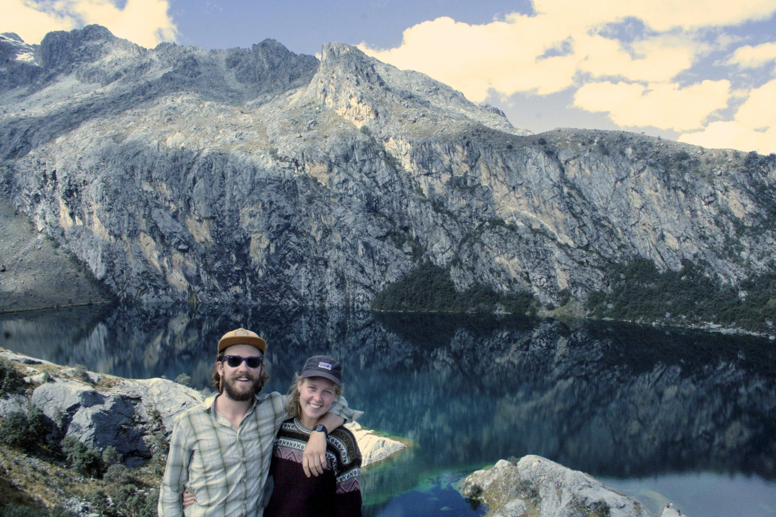
We actually broke up the trek by first stopping at the lovely Laguna Shallap, also accessible from Llupa, and then camped near Pitec. That gave us a night sleeping at 3850m before going up to 4300m.
If you're not worried about altitude, but distance, you could get a combi all the way to Pitec to shorten the day by an hour or two. And if you're worried about altitude, you there are many camp spots in the valley. However, it would make for a long day tomorrow over the pass.
From Llupa, it's all uphill on dusty road to Pitec. Ask any villager if you get lost, as there are many, and the trail is on maps.me. It took us 1 hour, but may take longer if the climb slows you down.
At Pitec you'll pass by the entrance to Laguna Churrup and head on the good road into Quebrada Quilhayhuanca. The road ends at the park boundary, where you climb over the fence and enter the lovely green valley. There were no staff here when we arrived at 10:00AM. This takes about 45 minutes from Pitec.
There's a path the entire way (also marked on maps.me) but it fades in and out of the boggy pampa. It's not necessary to stick to the path entirely, but it will help you cross some side streams faster and avoid the wettest parts of the valley.
The trail stays on the left of the valley for the whole day. 3 hours up after you enter the park, you'll reach the first proper campsite, which is signposted. This campsite is at 4000m, so could be a good option if you'd like to sleep relatively low. The worst altitude sickness comes on at night!
The path splits at this point.
Optional Side Trip: If you're interested, follow the trail to the right as it continues along Quebrada Quilhayhuanca. This will take you further up into the next valley to some gorgeous and tall peaks. Walk as far as you want, but plan for a 2-4 hour return.
If you're keen to keep going, bear left and begin to climb fairly steeply in a clear path into a side valley. After an hour, you'll reach a pampa where the trail becomes in distinct.
Continue on the left side of the river until a bit after the end of the pampa, where you'll need to cross over to the right side, about 30 more minutes.
The trail becomes clear again at this point, which is marked on maps.me. It's another 30 minutes up a forested moraine to the small campsite below Laguna Tullpacocha.
Unfortunately there's no view of the lake, but the camp will put you in good position to tackle the pass tomorrow.
Optional Side Trip: If you're up for another diversion, you can search for a small, unmarked side path to the lake. Pike's guidebook describes it, but we did not make the journey due to weather.
Day 2 - Laguna Tullpacocha (4300m) - Upper Cojup Valley (4200m)

Distance: 9km
Climb: 700m
Descent: 800m
Pass: Huapi (5020m)
Time: 6.5 hours
Navigation: moderate
Trail: moderate
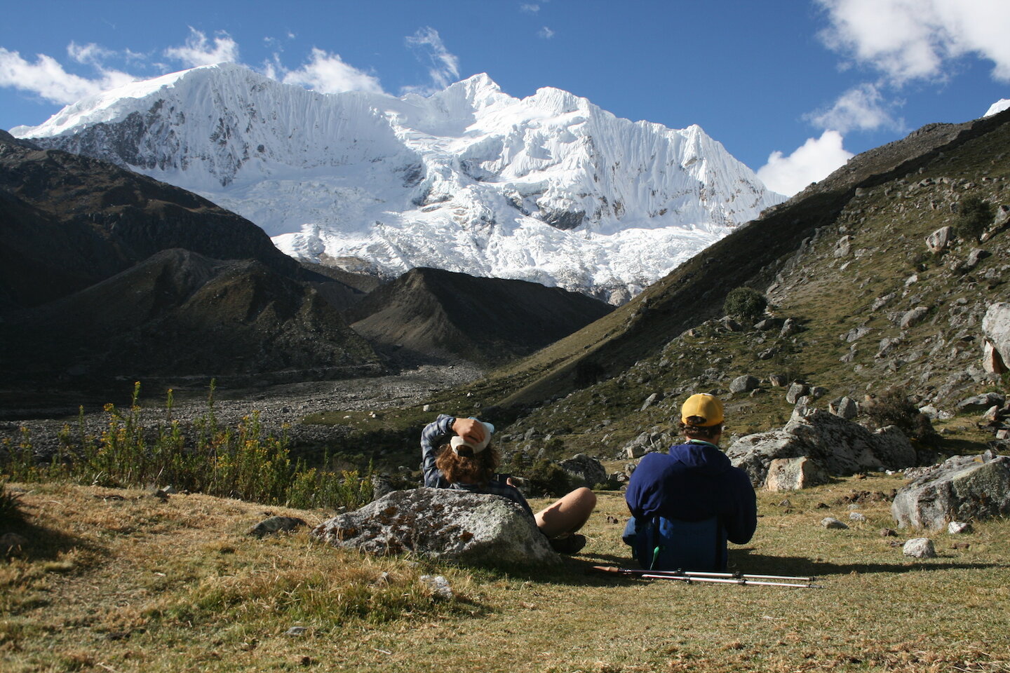
Today there’s a big pass. There's no way around it, but it's totally worth it for the views and very doable if you take your time.
Leave camp and immediately cross the river before following wide switchbacks up the side of a brushy hill.
After an hour, you'll reach the top and bear left when the path splits into two. There's camping here, though it high.
Optional Side Trip: You'll also have the option to take the path to the right and climb the moraine of yet another lake on a, which we'd estimate to be a 3.5 hour round trip.
On the main trail, you'll pass some ruins where the campsite officially is located, about 15 minutes on. Forge ahead, though the path becomes almost nonexistent.
There are a couple possible routes up the ridge in front of you. We chose the one in the center of the hill and followed cairns to the top until the faint path eventually bent left and around a small hillock and right again to a plateau with a small lake, more camping opportunities and a view. It took another hour to reach here.
The path climbs clearly to the left, where there will be more cairns to follow. It took 30 minutes to reach the so called Moo Lakes, plenty of cows, and the final but very high camp before the pass.
Cut through the center of the lakes and continue to climb slightly right on a rocky ridge for 15 minutes.
It's hard to tell where the path is taking you at this point. Indeed the pass is hidden, ahead of you to the right. You can't even see the spectacular mountain vistas that will shortly appear.
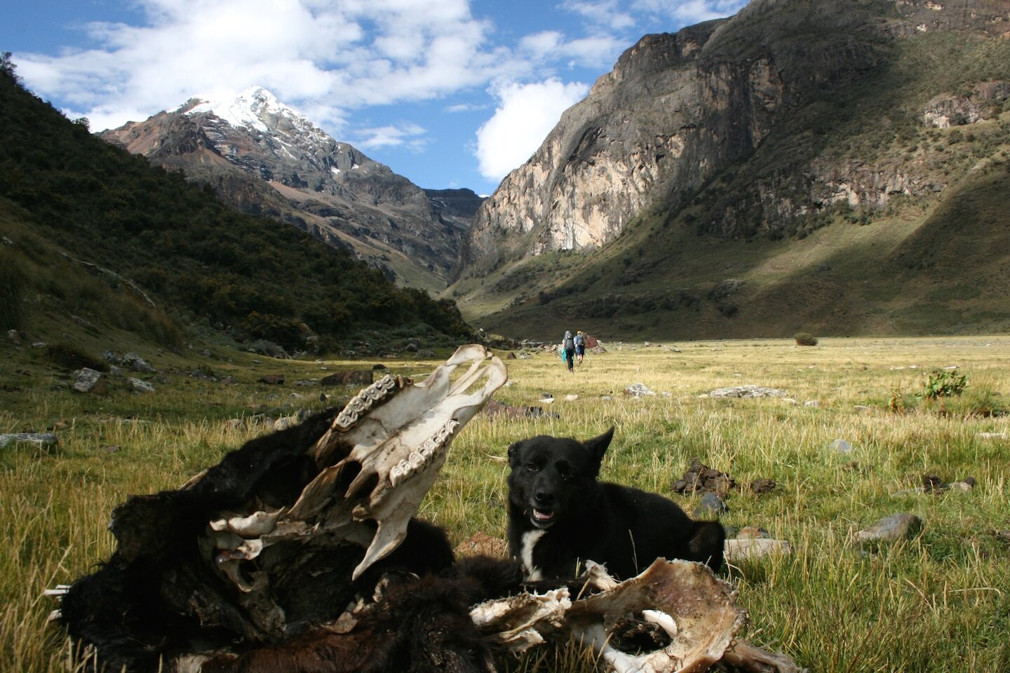
The path becomes rocky and traverses around the ridge line on your right hand side. It looks intimidating, but fear not: our cute little dog friend Caldo joined us for the whole walk and was totally fine.
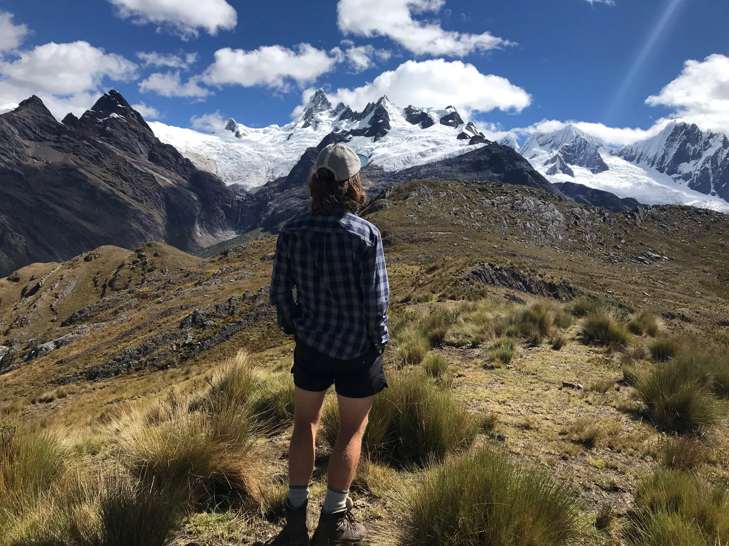
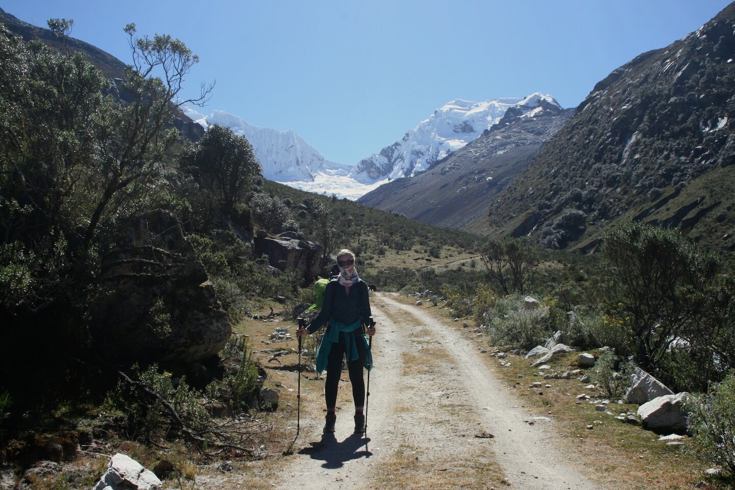
After 30 minutes or so of rock hopping, you'll make a final little climb to Huapi Pass and lovely views of Palcaraju that won't disappear for the rest of the trek. You'll also see Lake Palcacocha with its refugio (looked closed to us, but may be accessible in some seasons) and a 4x4 road all the way up to its base.
Optional Side Trip: You could walk up to the lake after you descend into Cojup valley, but it looked a bit industrial for our liking.
The other side of the pass is steeper, but very doable and isn't exposed so even if you fall all will be well. It changes from rocky to gravelly, so trekking poles are helpful to avoid slipping.
Follow cairns directly down to find the path. It winds its way slightly right, toward the mountains, passing the first water since Moo Lakes after about 30 minutes.
Take a break here for your knees as the path gets even steeper for a bit before coming to what appears to be a split in the trail (but may very well be a cattle track) in another 30 minutes.
Take the path on the left, which is grassy now, and follows close to a stream for 15 minutes or so.
Unfortunately, it also becomes indistinct. There are two marked trails on maps.me and neither are very visible. If you loose the trail, the going will be slow and frustrating until you find it again. We lost it for about 45 minutes, much farther to our right than we thought it should be.
We took a total of 3 hours to make it from the pass to our camp, which was significantly longer than the timings we saw. You may be able to do it faster if you don't get lost!
Eventually, after another 30 minutes or so, the trail will lead you past rocky outcroppings to a lovely little plateau. You could camp here, but it's a bit far from water.
Walk 15 more minutes down to the river. You'll see the road on the other side, but wait to cross until you see a small, if sketchy, bridge. Good camping is just 15 more minutes down the way.
Day 3 - Upper Cojup Valley (4200m) - Llupa (3500m)
Distance: 14km
Descent: 700m
Time: 4 hours
Navigation: easy/moderate
Trail: easy
It's a rather simple walk down the gravel access road and out the valley, with no navigation needed whatsoever. It took us 2 hours of continuously turning around to look at the mountain behind us to reach the gate to the park.
No one was there to buy a pass from. We climbed the gate and took the road to the left, which climbed a wee bit before turning sharply to the left.
Here you'll have to rely on your phone to understand the intricacies of the many shortcuts between sections of road on the way to Llupa. As a rule of thumb, keep heading down.
If you get lost, there will be the occasional villager to ask and you may even have cell service by this point.
Eventually you'll reach the lovely Chirrup Lodge and a brand new road. Follow this, avoiding all the switchbacks with shortcuts, and you'll pop out into Llupa, more than ready for a colectivo to a hostel.
All that road walking took another 2 hours and boy were we ready for the day to be over!
Final Thoughts
We’re so glad we did this trek as an alternative to Santa Cruz. So many travelers in northern Peru are looking for quick treks that offer best-for-your-buck scenery, and this gem is hiding right under their noses.
So go forth, explore, and enjoy your time in the Peruvian Andes!
Tried this hike? Questions before you go? Let us know in the comments!